MAP JHB 500;2526 Jhb Aero 1:500;37
R50,00
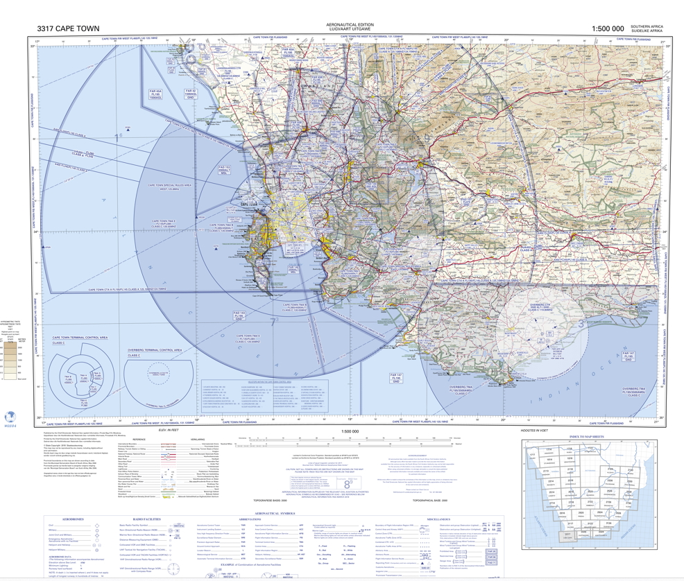
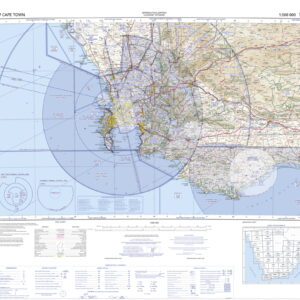
Johannesburg Aeronautical Chart (1:500 Scale) – Area Code 2526
This aeronautical chart, identified by the codes MAP JHB 2526 Jhb Aero, depicts essential information for pilots navigating airspace around Johannesburg, South Africa. The scale of 1:500 indicates a highly detailed map, offering a clear view of:
Airfield Layouts: Expect detailed illustrations of runways, taxiways, and other airport facilities.
Navigation Aids: The chart likely showcases the location of navigational beacons, instrument landing systems (ILS), and other aids crucial for precise aircraft positioning.
Obstacles and Terrain: This map should highlight potential hazards such as buildings, power lines, and uneven terrain surrounding the Johannesburg airspace.
Restricted Areas: Military zones, no-fly zones, and other airspace restrictions will likely be clearly marked for pilot awareness.
Related products
-
-
-
Map Aero
R50,00 -
